The 2023 Atlantic hurricane season forecast is ‘near-normal’ — but there’s a wild card
After a few years of heightened risk, the Atlantic hurricane season is shaping up to look pretty average for 2023. That’s thanks to an unusually long-lasting weather pattern called La Niña finally ending, with its counterpart, El Niño, expected to soon develop. The caveat is that there’s more uncertainty in this year’s seasonal forecast than normal because of unusually warm temperatures in the Atlantic.
Those factors tend to have opposite effects on hurricane season. El Niño generally ushers in milder storms in the Atlantic. But warmer waters provide more fuel for tropical storms to strengthen. So we’ll have to wait and see how these competing forces influence this year’s season.
There’s a 40 percent chance of a “near normal” Atlantic hurricane season this year
There’s a 40 percent chance of a “near normal” Atlantic hurricane season this year, according to an outlook released today by the National Oceanic and Atmospheric Administration (NOAA). But there’s also a 30 percent chance of an “above normal” season as well as a 30 percent chance of a “below normal” season when it comes to storm activity.
Between 12 and 17 storms are expected to grow strong enough to earn a name (reaching wind speeds of at least 39 miles per hour), NOAA predicts. Of those named storms, five to nine are expected to intensify into hurricanes. NOAA also anticipates up to four major hurricanes this year. For comparison, between 1991 and 2020, there was an average of 14.4 named storms, 7.2 hurricanes, and 3.2 major hurricanes per season.
Even with a “near-normal” season, coastal communities still need to be prepared, officials warned at a press conference today. “Remember, it only takes one storm to devastate a community regardless of the statistics I shared,” NOAA administrator Rick Spinrad said. “If one of those named storms is hitting your home or your community, it’s very serious.”
For the past few years, La Niña has set the stage for more intense storms to develop in the Atlantic. Both La Niña and El Niño are part of a recurring climate pattern that can influence the weather across the globe. In the Atlantic, La Niña tends to reduce vertical wind shear that otherwise might have prevented a tropical storm from intensifying.
La Niña finally came to a close in March, and now El Niño is expected to develop within the next couple of months. El Niño can usually take the edge off hurricane season because it increases vertical wind shear, which can tear storms apart as they try to strengthen.
Climate change also affects the hurricane season. Storms draw strength from heat energy at the surface of the sea. So with global warming, hurricanes have grown more intense. And recently, sea surface temperatures in the tropical Atlantic Ocean and Caribbean Sea have been warmer than usual for this time of year.
Similar to NOAA, another seasonal forecast in April from Colorado State University predicted a “slightly below-average” season. It also emphasized the outsize uncertainty in this season’s forecast based on the strange mix of forces brewing in the Atlantic this year.
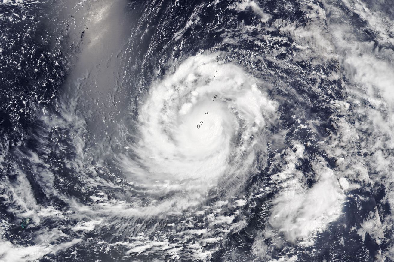
Typhoon Mawar just dealt a heavy blow to Guam, a US territory in the Pacific where the storm season starts a little earlier. Mawar made landfall there on Wednesday evening as the strongest storm to hit the territory in two decades before intensifying into a super typhoon with wind speeds above 150 miles per hour.
“We are waking up to a rather disturbing scene out there across Guam. We are looking out our door, and what used to be a jungle looks like toothpicks. It looks like a scene from the movie Twister, with trees just thrashed apart … Likely most of Guam is dealing with a major mess that’s going to take weeks to clean up,” a National Weather Service meteorologist said in a Facebook Live update this morning.
FEMA administrator Deanne Criswell said the storm shows how important it is to prepare for the upcoming Atlantic season. “As we are seeing the impacts of super Typhoon Mawar, what we are seeing is that these types of events are increasing and intensifying more rapidly,” she said at the press conference today. “Regardless of the number of named storms that are out there, regardless of the time of year with whether we’re in the peak of hurricane season or not, it just takes one.”

